Dr. McGarry is an Associate Professor of Science Education
with the Center For The Environment at Plymouth State University, and Director of Education for Hubbard Brook Research Foundation. She works with Jackie Wilson, Education Consultant for the HBRF, to create curricula and provide professional development for teachers that fosters public understanding of the functions of ecosystems and their importance to society. This site is administered by both Dr. McGarry and Jackie Wilson (jwilson@hbresearchfoundation.org).
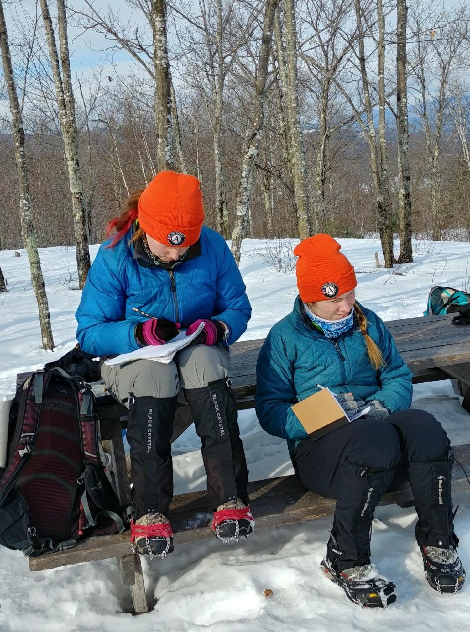
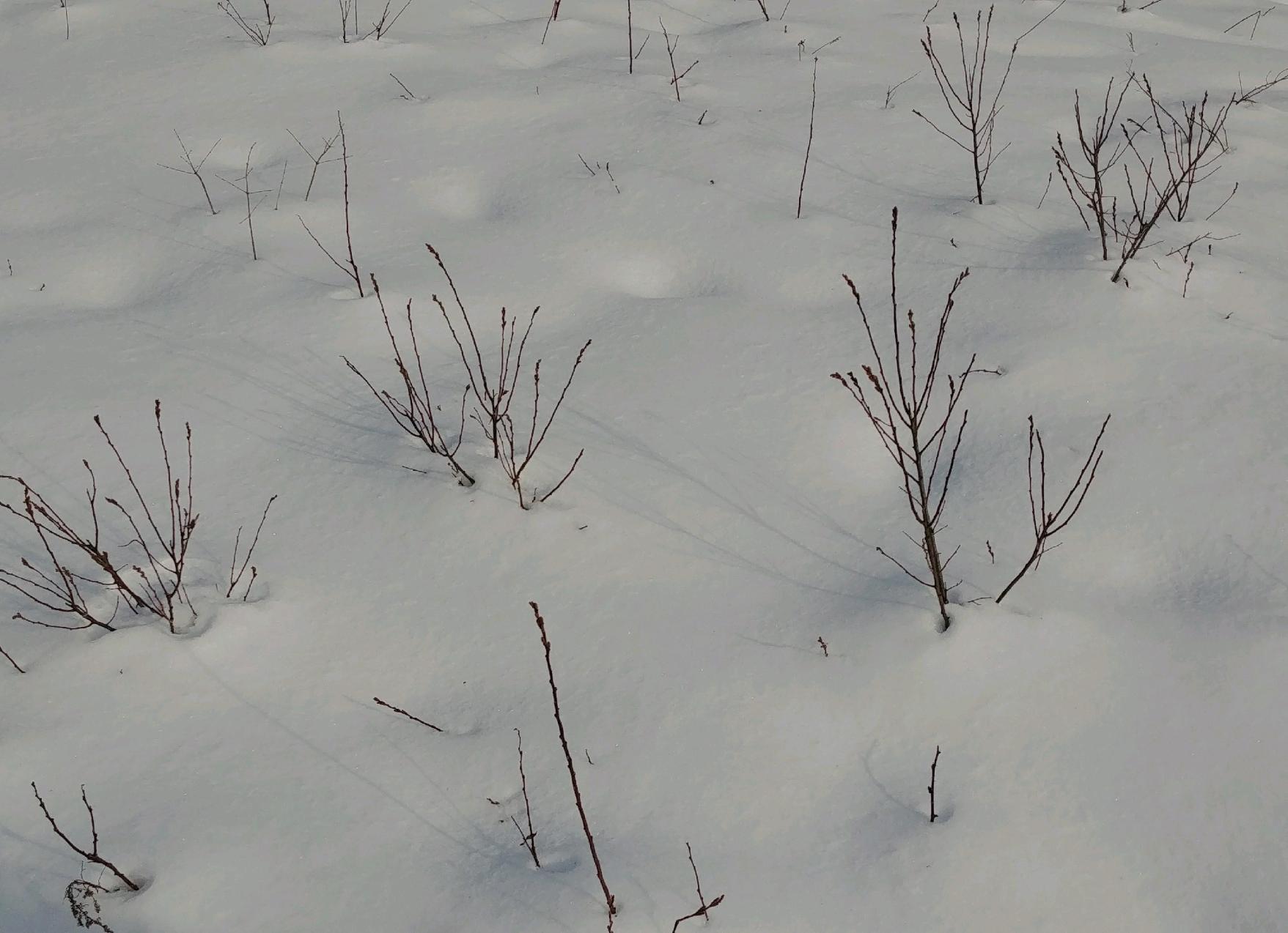
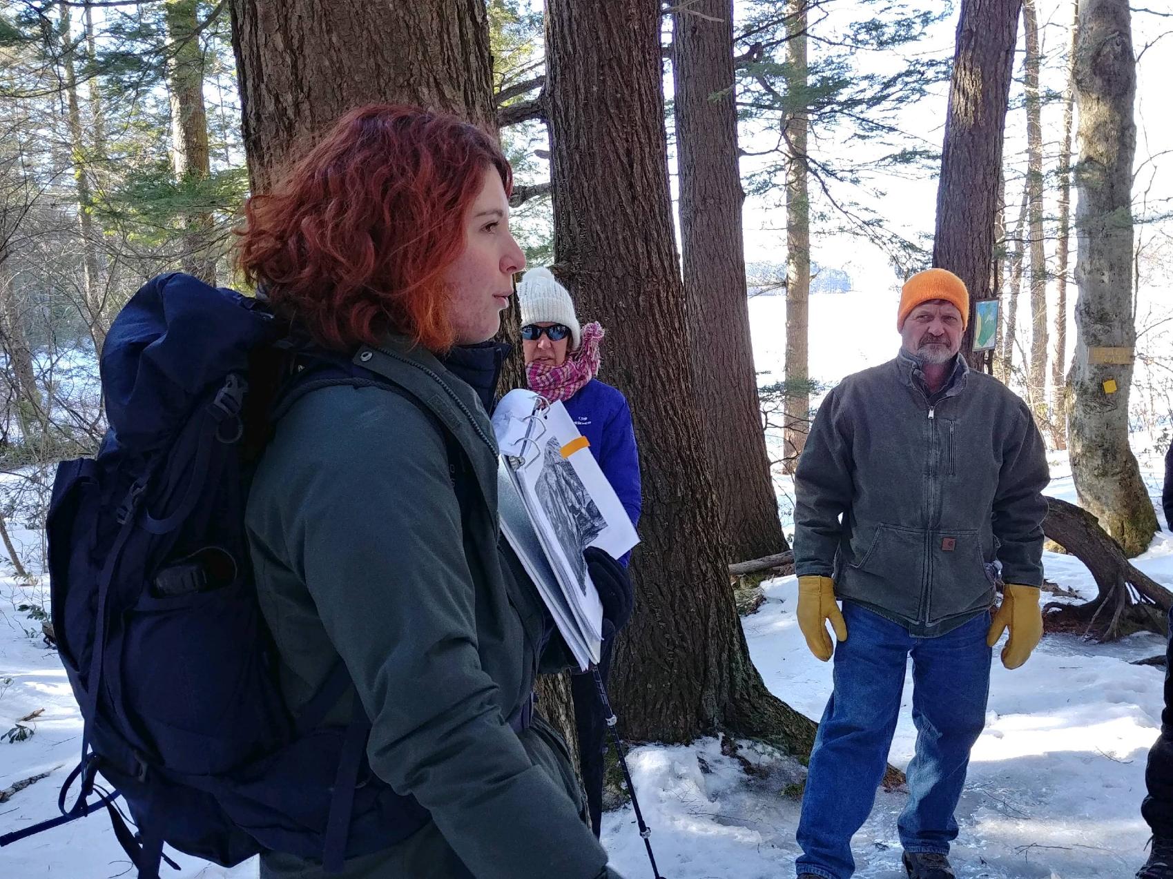
What could be better than spending time writing poetry with my daughter on a Saturday morning? I attended the “Mindful Journaling” workshop led by Amanda Carron- an impressive Americorps volunteer with Squam Lakes Association. Amanda has a Master’s degree in Natural Resources with a certificate in Environmental Education from the University of Idaho and she offered a great collection of writing prompts. Lucky Sydney who gets to work with her and served as her assistant. I was sorry the 2.5 hour session hiking around Whitten Woods had to end. I really enjoyed sketching and reading and sharing our writing.
New England Forestry Foundation owns the 400+ acre property and Squam Lakes Conservation Society holds conservation and trail easements.
One of the other participants had three daughters who attended Saint Lawrence University, Sydney's alma mater, so the two of them had lots of connections.
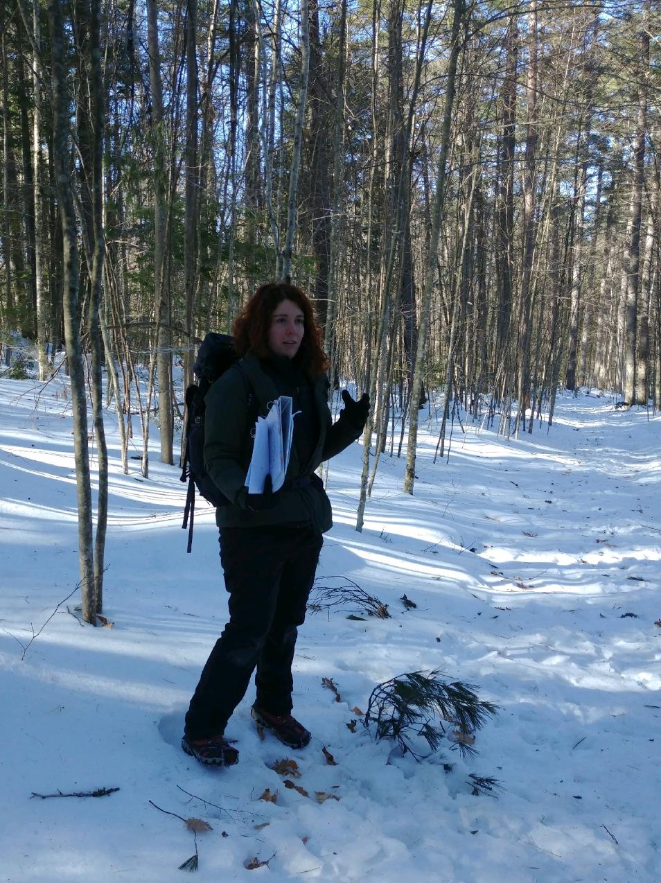
I teach about the culturally, historically significant Whitten woods site in my Plymouth State University classes and was happy for another chance to trek around in the winter. More than a hundred years ago, Reuben Whitten fed his neighbors with food he grew on his elevated, south facing property overlooking the Squam watershed, during the year without a summer. His success followed the 1815 eruption of Mount Tambora, on the island of Sumbawa in Indonesia; one of the most powerful volcanic eruptions in history with a Volcanic Explosivity Index (VEI) of 7.
Mount Tambora was 14,100 feet before the explosion and is now 9,254 feet high. The explosion was reportedly heard 1600 miles away and ash fell 810 miles from the site. The amount of ash put into the atmosphere lowered global temperatures and caused sunsets to be red and orange with purple and pink above as reported in England. Sunspots were visible in the dark, dimmed, daytime skies. The colorful skies were beautiful but the famine that followed was not.
The decrease in average global temperatures from all the ash emitted caused significant agricultural problems around the globe, in China, Europe, and North America. In June of 1816, frosts were reported and snow fell in northern New England. "Reuben Whitten and his wife shared 40 bushels of their wheat with 100 neighbors who were less fortunate, an act of generosity that was later recorded on a memorial stone by their grandson, in 1911," https://nhpreservation.org/…/2018-preservation-achievement-…. Their house has been moved to Ashland and is now on the state historic registry in recognition of Reuben's contributions almost 200 years ago. 1816 has been referred to as the year without a summer.
The cooling climate was blamed for typhus epidemics and disrupted the Chinese and Indian monsoons, causing failed harvests resulting in famine. In Ireland the wheat, oat, and potato harvests all failed. The documented rainfall was as much as 80 percent more than the calculated normal, with unusually high amounts of snow in Switzerland, France, Germany, and Poland. The most interesting cultural phenomena is the claim that some countries could no longer grow grapes and switched to hops to brew beer
Tambora currently has an active vent being monitored by the Directorate of Vulcanology and Geological Hazard Mitigation, Indonesia. I urge my environmental science and policy student to consider pursuing hazard mitigation as a career; we certainly don’t have any shortage of natural disasters, especially as the population continues to increase.
I visited Vesuvius, Etna, and Pompeii for my last sabbatical; maybe I can investigate Tambora next.
References:
Brönnimann S, Krämer D. 2016. Tambora and the “Year Without a Summer” of 1816. A Perspective on Earth and Human Systems Science. Geographica Bernensia G90, 48 pp., doi:10.4480/GB2016.G90.01; https://boris.unibe.ch/81880/7/tambora_e_web.pdf.
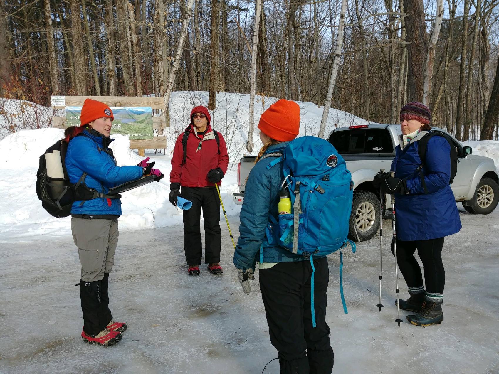
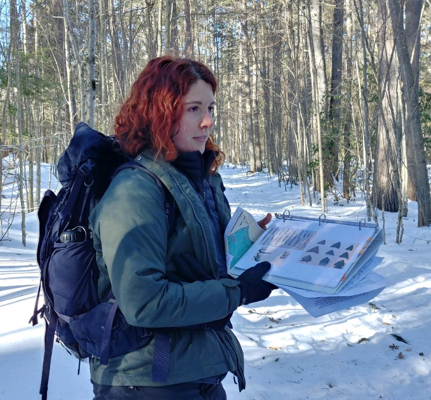
So glad I joined Americorps volunteer Adel Barnes on her guided "walk through time" on the Chamberlain-Reynolds Memorial Forest perimeter loop trail for Squam Lakes Association. She covered the first people who lived in the Squam area, ending with discussion about conservation today. Hearing Adel's perspective about the contrast between the 29 recognized Native American tribes in her home state of Washington with the fact that there are none in N.H. made her story about the impact of the Seven Year or French and Indian War in the New England area, (1754-1761), more interesting. Less than 1% of the current NH population claims to be of Abenaki descent- the Abenaki is the name of the native people who inhabited Grafton and Coos County before European contact.
I visited the 2018 NH State Conservation and Rescue Archaeology Program (SCRAP) that documented Native American occupation at “the Hollow” on the Pemi River at Livermore Falls, but I did not know about the archaeological sites on the two sides of the river connecting Big and Little Squam. A local woman hiking with our group remembers finding artifacts as a young girl when she was visiting the owners of one of the sites on the river.
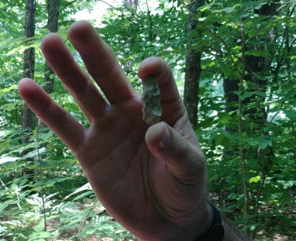
A 12,000-year-old spear point was found near Jefferson, NH in the 1990's and nearly 60 other Native American sites have been identified around New England. Based on stone tools and other artifacts found near a Jefferson site in 2017, the area was believed to have been used for hunting and slaughtering caribou that were present after the Ice Age before forests covered the terrain. Pieces of stone from as far away as Maine and New York have been found suggesting the the Native Americans at this time were nomadic – following herds. Volunteers excavating a shallow pit in Jefferson in 2017 also found a collection of softball-sized stones which could have been the remains of a sweat lodge.
The new, more recent history that Adele shared about the people who visited Squam, was about guests coming to the area during prohibition, where a room key came with alcohol.
Adele had lots of old photos to illustrate the different eras on Squam, part of the archive at Squam Lakes Association.
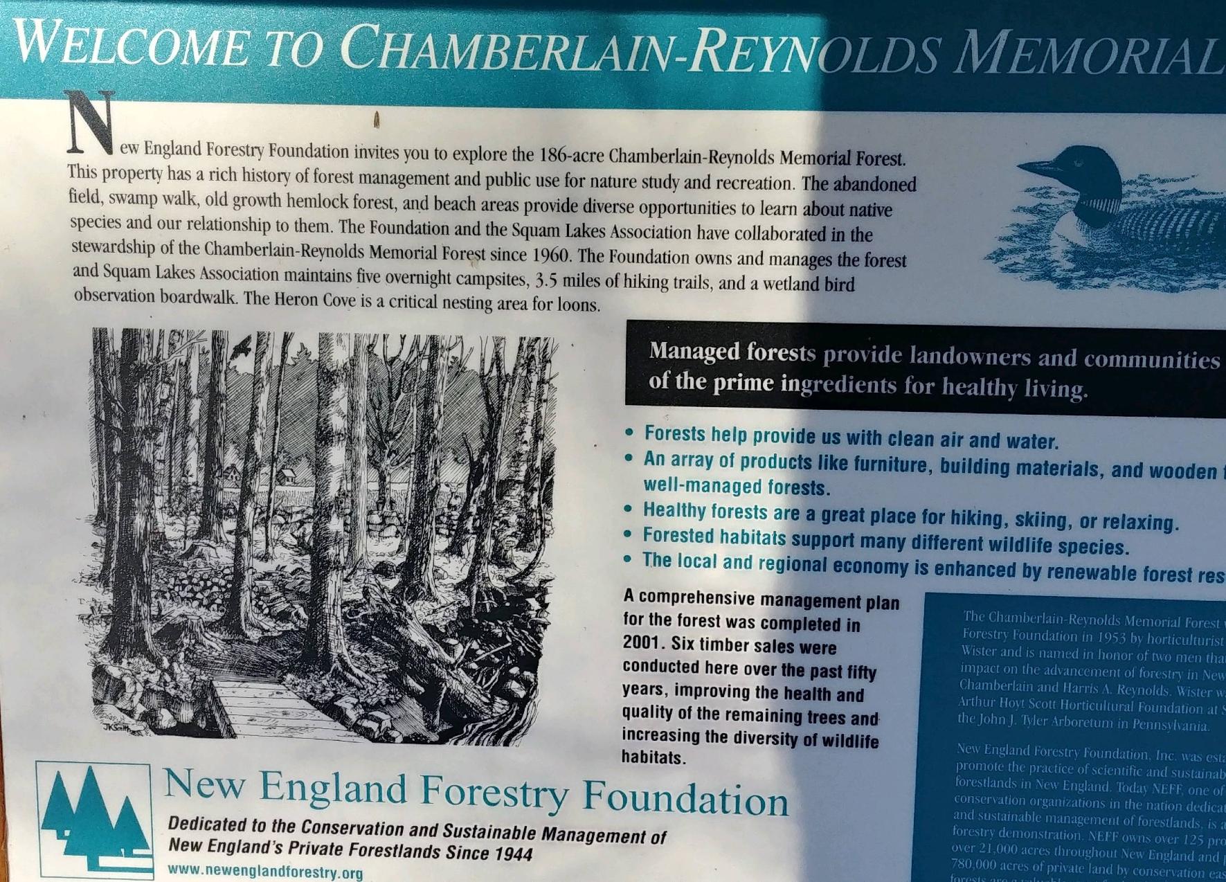
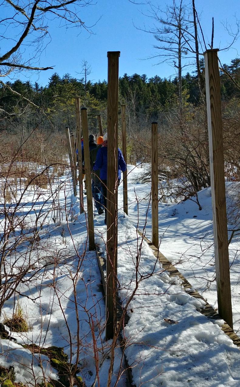
I was particularly interested to hike on the property as one of my PSU classes is looking at conserved forests in the area. This 186 acre property has abandoned fields, a swamp, old growth hemlock, and beaches. Heron Cove is a critical nesting area for loons. The New England Forestry Foundation owns and manages the forest and SLA maintains 5 campsites and 3.5 miles of trails. The two organizations have collaborated since 1960. The forest management plan has include at least 6 timber sales. The NE Forest Foundation has been in existence since 1944.
Many people think that because a site is designated as a State Forest that it is “protected”. This is not true! The land is indeed protected from private development. However, the land is still open for commercial harvest of timber resources by state and private enterprises. In fact, Livermore Falls State Forest is actually home to a wealth of timber resources! When I recently visited the site, I was able to identify over 10 different species in less than an hour, including Black Cherry, American Elm, Paper and Yellow Birch, and American Beech. Some of the species like black cherry, do not have many commercial uses. However, other species present like Eastern Hemlock, Red Maple, Red Oak, and Eastern White Pine have many commercial uses, and are valuable resources for the towns of Holderness, Plymouth, and Campton.
The site is managed by New Hampshire Department of Fish and Game and the New Hampshire Department of Resources and Economic Development, Division of Parks and Recreation. The forest is maintained in a sustainable way. The site is available for commercial harvest, but the forest has not been used for commercial purposes since the late 1800’s. In the event that a contract is given that allows commercial harvest, the Department of Fish and Game only allows one percent of the forest per year to be harvested at a time. This allows 100 years of regrowth before the initial one per cent is recut.
Eastern White Pine
Eastern White Pine (or Pinus Strobus if we’re getting technical) can be found at Livermore Falls in abundance. It is the largest of the Northeastern conifers. Common uses for this tree are for construction, including boat building, for crates and boxes, and for carving of artisanal crafts.
There are 3 keys to identifying this tree.
Needles – They grow in bundles of 5. This number is important when identifying any coniferous tree. They grow to approximately between 6 and 10 cm and are distinctly straight.
Bark – It is typically grayish-brown with deep, pronounced furrows. The ridges between the furrows are characteristically wide and rectangular, and can often appear to be topped with purplish scales.
Cones – Staminate (When you are looking at this tree, the staminate cones are the heavy/dense ones that have yet to open) cones are approximately 10-15 mm in length, have a distinctive yellow/green hue, and are oval in shape. When the cones open (typically takes about 2 years) their color changes to a pale gray-brown. They can then grow to between 8 and 20 cm.
Eastern Hemlock
The dominant tree species at Livermore Falls is undoubtedly the Eastern Hemlock (Tsuga Canadensis). These trees typically grow to be about 40-70 feet tall. Like the Eastern White Pine, the lumber has an abundance of industrial uses. It is very commonly used for construction, firewood, and pulpwood- to produce paper products.
Once again: needles, bark, and cone characteristics are very helpful in identifying this tree.
Needles – Unlike pines, hemlock trees have much shorter needles. The Eastern Hemlocks needles only grow to be about ½ inch long. The needles grow in 2 tight rows on opposite sides of the stem, with one of the rows slightly pointed upwards. They have a distinct “white” line that appears on the bottom of the needles.
Bark – The bark is red-brown in color, as opposed to the grayer bark of the Eastern White Pine. The bark has a scaly appearance in its more juvenile years but develops furrows and ridges as the tree ages.
Cones – The cones are small and abundant, typically growing to be about 1 inch long. The cones are light brown and they “open” less than other cones.
Red Oak
The dominant hardwoods at Livermore Falls State Forest include red oak. (Quercus Rubra), whichis very abundant at the site.. Its wood is significantly denser than pines and hemlocks, so its timber is used in different ways. Although it is still sometimes used as construction lumber, red oak is typically used in a more ornamental fashion, for furniture, cabinetry, flooring, and interior trim.
Deciduous trees do not have cones, so the leaves, bark, and acorn shape are the main identifying features.
Leaves – Red oaks typically have between 7 and 11 lobes to each leaf. The lobes are toothed, as opposed to white oaks which have rounded lobes. Red oak leaves are deep green in the spring/summer months and have grayish-white bottoms. In autumn, they turn a brownish-red.
Bark – Young red oaks have relatively smooth, light gray bark. As the trees age, the bark’s color darkens to a dark-grey, and it begins to develop furrows. The mature bark is typically identified by its plentiful flat-topped ridges. Furrows are more prominent towards the base of the tree, giving way to more pronounced ridges further up the trunk.
Acorns – The acorns are differentiated by their distinctively flat cap that is thin, and doesn’t encompass more than ¼ of the nut. White oak acorns have a deeper cap and a slightly lighter color. Red oak acorns are typically around 1 inch or smaller in length.
Red Maple
The Red maple (Acer rubrum) produces very sought-after timber. Like red oak, Acer rubrum is often used for furniture, cabinetry, flooring, and interior trim. However, it is also very popular in the production of woodwind instruments, adding to its value. The wood is also still used as construction lumber in some cases as well.
Similar to red oak, its leaves and bark are essential in its identification. . Maple trees don’t have acorns OR cones, instead they have samaras (commonly known as seed helicopters).
Leaves – If you need a good example of this leaf’s typical appearance, visualize the Canadian Flag. Although the flag does not exactly portray the red maple leaf. . Red maple leaves have between 3 and 5 lobes depending on the age of the tree. The lobes are toothed, much like a Red Oak, and the stalks of the leaves are red. This is the most spectacular tree to view in autumn, as it produces a beautifully vibrant array of colors as the green leaves turn yellow, orange, and red.
Bark – Similar to the red oak and most other trees, this tree’s bark changes as it grows. Young trees have a smooth, gray bark. The mature trees’ bark is dark-gray in color, and have a vast array of vertically oriented scaly-plates.
Samaras – The seed pairs are typically red-brown in coloration. They are about an inch wide, and when dropped appear as mini “helicopters” twirling to the ground.
Why Do We Care?!
Since the Livermore Falls site is designated as a “State Forest”, any money earned by the state off of the timber would be immediately cycled back into the state budget. This could contribute to the budget to improve infrastructure throughout the state, or perhaps be used to increase funding for public schools.
Although New Hampshire remains largely forested, it is the second most forested state in the nation after Maine. Deforestation is breaking records every year. In 2016, a new record was set as 29.7 million acres of forest were cut globally, an area roughly the size of New Zealand. Forests such as at Livermore Falls have many benefits in addition to revenue which could be generated from sales of timber. Our forests are our planet’s primary source of respiration and forests help combat climate change. Certain species of trees can absorb up to 48 lbs. of CO2 per year! An acre of forest can absorb the amount of CO2 a car travelling 26,000 miles in a given year would generate. At 178.34 acres, Livermore Falls State Forest could absorb the CO2 produced by 4,628,000 miles of car travel annually!
Trees do even more than sequester carbon dioxide. Forests also mitigate the effects of rising temperatures. Differences of up to 19 degrees Fahrenheit have been found between forests and adjacent cleared land. Forests also supply food for animal populations as well as recharge groundwater supplies and sustain stream flow in times of drought. F. Forests next to rivers like at Livermore Falls also serve as buffers protecting water quality for aquatic organisms.
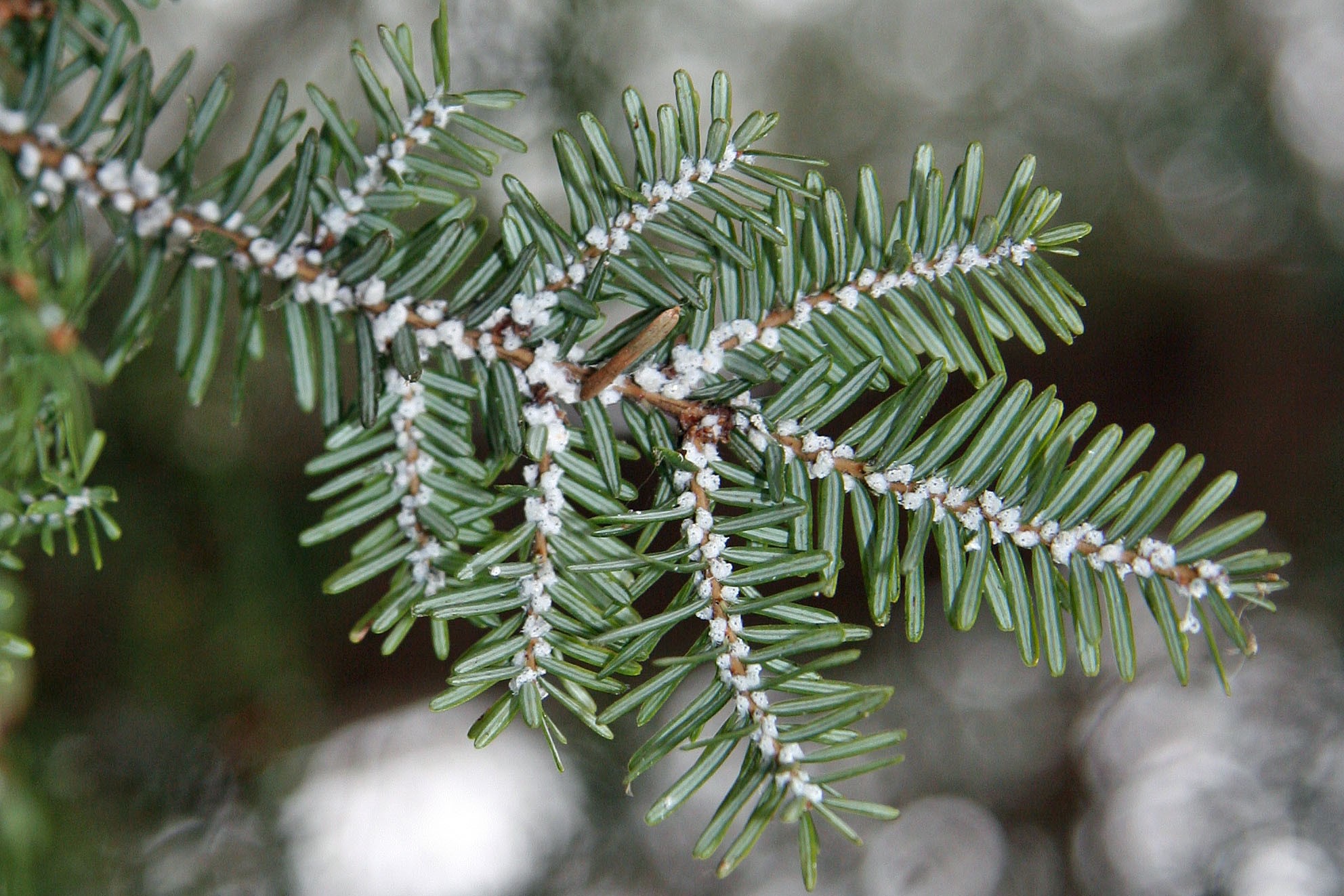
NH forests are under threat from invasive insect pests, like the Hemlock Woolly Adelgid (HWA). The bulk of the forest at Livermore Falls that is found on higher ground, above the riparian zone, is comprised of Eastern Hemlocks. The HWA is an avid like insect that lays up to 200 eggs per liter. The hatchlings feed on the tree’s stored starches until they are depleted. At this point, the tree doesn’t have enough stored energy to survive and the HWD finds a new host.
The presence of HWA can be seen as white woolly masses that form on the underside of branches at the base of the needles as seen in the photo. It looks as if fresh snow has fallen.
New Hampshire has an action plan to restrict the spread and manage Hemlock Woolly Adelgid within the state, revised in March of 2015. The plan was developed by the NH Division of Forests and Lands within guidance from the Forest Pest Advisory Group which is comprised of specialists from a number of organizations- the NH Department of Agriculture Markets and Foods, UNH Cooperative Extension, The Society for the Protection of NH Forests, the Nature Conservancy, the Granite State Society of American Foresters, and the USDA Animal Plant Health Inspection Service. The insect is spread by wind and wildlife naturally, so we must watch for the HWA presence at Livermore Falls site. Resource about the pests and what to do if you spot an infestation can be found at a New Hampshire state website: https://nhbugs.org/hemlock-woolly-adelgid.
Insecticides or biological predators, or an combination of both can be used to control infestations. Spread of invasives is controlled by not allowing firewood to be transported across state lines. Infected trees can also be harvested. A host of resources available to educate landowners and citizens of NH, specifically notice of outbreaks can be sent to those involved in monitoring and tracking using the online form at: https://www.nhbugs.org/reporting-form.
References:
Action Plan To Restrict The Spread And Manage Hemlock Woolly Adelgid Within The State of New Hampshire, 2015, https://www.nhdfl.org/DRED/media/Documents/HWA-action-plan-15.pdf.
Gray & Pape, Inc., Cultural Landscape Report and Environmental Assessment Livermore Falls, Grafton County, New Hampshire. December 22, 2015. Retrieved November 8, 2018.
When students at Plymouth State think about Livermore Falls many of us may associate it as a place to swim with friends and jump off risky high places for an adrenaline rush. In reality Livermore Falls is home to much more.
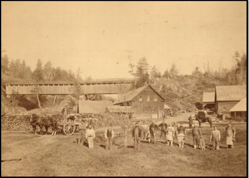
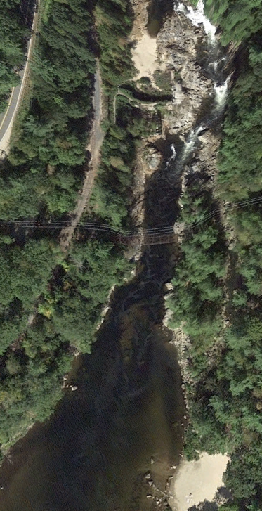
Livermore has been a focal point in the area throughout history because of its geological and other natural characteristics. The geology causes the narrow constriction producing the waterfall which provided opportunities to establish mills dating back to 1700, refer to Figure 1. The falls lie at the junction of three different towns: Holderness, Campton and Plymouth. Where the Pemi forms a cascade is an ideal location to generate power and many have recognized this.
Figure 1. Aerial view of Livermore Falls. Upstream is to the left. Photo by Owen Ginty.
When we look back over time, there are a couple of significant dates. One of the more important is 1759, when the French were defeated in Quebec; borders became more established and this made settling the area of Holderness feel safer, and free of worry of having to be relocated in the future. This was the beginning of development in the area.
Then, in 1771 a gentleman named Moses Little who served as Moderator, selectman, and Justice of the Peace, bought thousands of acres around the falls and built a saw and grist mill. In 1773 the first mill was constructed along the west side of the river.In 1827 Judge Arthur Livermore acquired the property of Moses Little; and renamed the falls after himself.
Thirty-six years later in 1886 a company called Berlin, which is a company out of Connecticut who specializes in iron bridges, built a 263 ft. double span inverted deck trestle which sits 103 feet from the surface of the Pemigewasset River. The existing pieces are the only remnants of what is referred to as the “Pumpkin Seed Bridge,” refer to Figure 2.
Figure 2. The 263 ft bridge for cars sits over the river just below the falls and was closed in 1959. Photo by Owen Ginty.
The bridge closed in 1959; the eastern side was cut loose and dropped making it no longer possible to cross, but this hasn't stopped daredevils from using the bridge as a jumping platform, causing serious injury to some.
A series of mills for different purposes were built at the site and then were subsequently destroyed by fire or flooding. In the 1950’s the mill ceased operation. With the lack of upkeep the mill became a focal point for vandalism. A flood in 1973 washed away part of the mill, further destroying the structure. A dam and power house were taken out by flooding.
Eastman’s White Mountain Guide lists Livermore falls as “wild and romantic scenery”. A Holderness townscape study done by U Conn professors Rudy Favretti and John Alexopolis hailed Livermore Falls as a “priceless natural resource”.
The Wild and Scenic Rivers Act was passed by congress in 1968 to protect certain free-flowing rivers for recreation for current and future generations. The Act’s main purpose was to balance out the nation’s long-standing water resource development policy with river conservation policy. As development along the Pemi continued, a local group lobbied to have the headwaters of the Merrimack designated as a Wild and Scenic River. A study was commissioned and conducted in 1996, but surrounding towns including Plymouth, Campton, and Holderness voted against the designation, but much useful conservation data was collected, .
There was a proposal to build a hydroelectric power plant in 1988 although it was denied by the Federal Energy Regulation Commission after numerous hearings. A key reason for denying the proposal of the plant was that in times of high runoff it could cause flooding upstream 15 miles to North Woodstock.
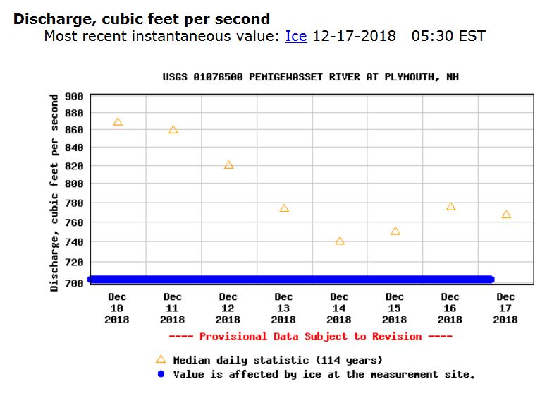
The hydrology of the Pemi above Plymouth is interesting because there are no retention or flood control dams. Therefore gaging stations are important for alerting people to rising river levels. The first gaging station in NH is located downstream in Plymouth, NH. and another is upstream in Woodstock. Citizens can access real time discharge data to see how fast and high the river is flowing, or as is indicated in Figure 3, that the river is covered in ice: https://waterdata.usgs.gov/nh/nwis/uv?site_no=01076500.
Figure 3. Discharge information from the USGS gaging station in Plymouth, NH, downstream from Livermore Falls, showing ice cover in December, 2018.
“Pemigewasset Wild and Scenic River Study.” Rivers.gov, New England System Support Office, Department of Interior , Mar. 1996, www.rivers.gov/documents/studies/pemigewasset-draft-study.pdf.
(refer to important disclosure statement at end of post)
Andria Moglia edited by Mary Ann McGarry
Exploring the culture of the people who once inhabited the sites we now occupy can help us make a connection with our community. Such place based learning can engender stewardship of rich archaeological and historical resources. Livermore Falls is a site worth preserving for its many natural features and as we are discovering the layers of archaeological treasures from many settlements- spanning pre-European Native Americans to mill operations to the current status of being a NH State Park under development. Take a Trip Back In Time. Imagine it is the year 1820 and you awaken before dawn to the running river outside your window; the rooster squawking, and the yelling of workers entering the mill for their morning shift. You get out of bed to eat breakfast before going to work at the Tannery next door. Your mother and father are having coffee in the kitchen as you walk in to join them. You are 12 years old and do not go to school; the only friends you have are the ones next door and across the dirt road; you work at a shoe shop with your father. One day on your break at work, you find a slightly curved rock that has slightly, uniform raised ridges. On first glance the piece looked like a piece of hardened, consolidated earth. You wonder about who created and handled this piece of pottery. In examining the material carefully, you notice the grooves and edges of the piece and fixate on the patterns. The pottery piece is more reddish in color in contrast to the soil in which it was found. You take it to your father at the tannery and he doesn’t seem to care as much as you do, so you take it home and put it in a safe place. Days later you find another piece. The edges fit together just like puzzle pieces.
Figure 1. The tannery area of the Hollow, 1875, looking upstream, Pemi River is to the left, area is now forested.
Archaeologists like piecing together stories about past cultures. To do so accurately, they have developed a set of protocols and they rely on multiple sources- artifacts like the pottery piece and historical documents to determine who lived where, when, and how. Patterns on pottery is one way to date cultures. Information gathered from multiple sites in an area helps complete and verify records. Pre-woodland sites have been documented on the Pemi River downstream from Livermore Falls. Surely, the pool at the bottom of the falls was a great site for fishing and camping during salmon migrations.
Pottery piece extracted from SCRAP Archaeological Dig, Livermore Falls, NH, summer 2018
Abenaki Who?
You may be wondering, what does Abenaki even mean, and who were they? They are just like you and me, except they existed 2,000 or more years ago (David Trubey). They hunted and fished for their food and used the nearby river, known as Livermore Falls, for many purposes. Their presence portrayed a natural lifestyle, one that many, today could not obtain. Through the findings of miniscule pieces (flakes), archaeologists can say that the Abenaki tribe did not just pass through New Hampshire but remained for a long period of time. According to UnionLeader.com, “All Abenaki were killed off in the early 1700’s, which could not be true referring to historical records that showed Abenaki families living and interacting in communities across New Hampshire”. By understanding why certain artifacts were made this way, or why it was found in that location is what archaeologists try to answer when conducting digs. Then, they try to uncover who made the artifact, what brought them there to settle and for what purposes did they make the object for. The power that comes from the artifact is incomprehensible; to hold it and feel its value is an unforgettable experience, and I now see why archaeologists love their jobs. If you ever get the chance to work in the field with experienced diggers, take the opportunity, and get to know the land in which you stand on, because one day you will be leaving something behind that someone will someday find, and ask the same questions we do.
Scrap
David Trubey and Edna Freighner are two important leaders of SCRAP (State Conservation and Rescue Archaeology Program) excavations. They work to ensure proper preservation techniques are used, and instruct all participants on helpful skills needed to handle the task at hand. Before beginning a SCRAP dig, the first step includes the where; where will this dig begin, and how do we know that this location could be an area with possible findings. When discussing these questions with David and Edna, the most important step to consider is to observe historical maps of the site before allotting time to set up a dig. First, you want to observe previous maps that give clues to major objects that could have been left behind. For example, at Livermore Falls, there are cellar hollows, and stone walls that indicate there were previous peoples living there. “The next characteristic to look for is a major water source within 200 meters of the terrain. This is because these water sources not only provided safe drinking water, but food sources such as fishing and water fowl (Trubey).” Archaeologists also acknowledge soil type when looking for areas of pre-contact (hearth compromised of fire-altered rocks and charcoal) or post- contact (cellar holes) archeological sensitivity; they work around what is already there to determine the land in which it was hundreds of years ago.
There are specific sampling protocols to follow at archaeological sites. According to archaeologist David Trubey, once a dig is officially ready to be tested, “Transects are spaced eight meters apart along a compass heading. Shovel test pits (50 cm x 50 cm) are then dug at eight-meter intervals. This method creates a grid over the land form, ensuring the area is sufficiently tested. If any archaeological feature is found, then the next step is to dig one meter by one-meter excavation units," (conversation with David Trubey).
Who Cares?
Who cares about the past, if it isn't part of our modern daily lives, why does it matter? We tend to care about topics that relate to us, and hold meaning in our lives. David Trubey and Edna Frieghner have conducted SCRAP digs with college students and community members in the Plymouth area and other locations in New Hampshire to explore and unravel the past as recorded in buried sediments. The SCRAP digs literally bring history to people's fingertips as volunteer workers shift and shovel through different layers of soils exploring evidence of people who previously inhabited the land.
Past, Present, Future
Think about all the items you use in your everyday life, like cell phones, toothbrushes and so on. With more than seven billion people on this planet the amount of trash and “artifacts” from our consumer lifestyle that will be left behind is staggering. Archaeological digs show a time lapse of what occurred on the land overtime. The left behind objects at Livermore Falls include: pieces of shoes, nails, flakes chipped from rocks, rusted horseshoes, and more. The amazing story at Livermore Falls is that there is evidence from multiple cultures through time, beginning with Native Americans before the arrival of Europeans continuing through all the mills that operated on the banks of the Pemi River. “For the historic period, archaeological sites balance, expand, corroborate and contradict the written and oral records of the past,” (nhdhr). The future of the Livermore Falls site is the creation of a State Park that will provide interpretation about the history that was preserved at the site. The story is still unfolding as information is brought to light through the SCRAP digs.
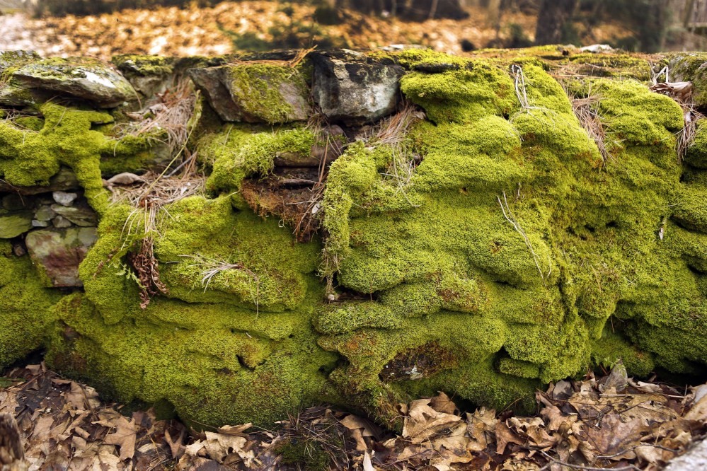
Figure 2. Moss covers the remains of a foundation in an area known as the Hollow, Campton side of the River, downstream from the falls
Conclusion
History is embedded within the soils beneath our feet at Livermore Falls. Learning about cultures that preceded us in the Plymouth, NH area is partly understanding how and why we are here.
Photo by: Andria Moglia
Disclosure note:
As a responsible member of society, it is important to keep in mind that archaeological sites, including those found at Livermore State Forest, are nonrenewable resources. We have to be aware that these sites hold information from pre and post contact life which can easily be lost forever. As these sites are also a part of a NH State Forest, it is ILLEGAL to remove artifacts, dig or metal detect. This is a place where good stewardship is necessary to preserve the landscape’s historical and natural features for future generations.
Brooks, David. “Archaeology Camps Take You Back 200 or 2,000 Years in NH.” Concord Monitor, 2 Apr. 2016, www.concordmonitor.com/News/Local/Archaeology-camps-take-you-back-200-or-2-000-years-in-NH-1214764.
Feighner, Edna, Archaeologist. NH Division of Historical Resources. Personal interaction - Fall, 2018.
SCRAP Field in Historical Archaeology. The “Hollow” Livermore Falls, NH July 9-August 3, 2018. Retrieved November 13, 2018. https://www.nh.gov/nhdhr/scrap_info.html.
Trubey, David, Archaeologist. NH Division of Historical Resources. Personal interaction- Fall, 2018.
A brief look at the importance of State Forests and the benefits they provide us, here in New Hampshire, with a focus on Livermore Falls State Forest
The United States Forest Service (USFS) manages nearly 800,000 acres of forest in New Hampshire. 280,000 acres are open for harvest, and only around 800 acres per year are actually harvested (Roger Boyer, USFS).
The value of forests is not just economic, but social and environmental as well. In New Hampshire most of the services provided by the USFS are targeted at tourism and recreation, which can benefit all three sectors. Most people believe harvesting trees is negative, but a case may be made that sustainable management promotes biodiversity and healthy forests.
Importance of Livermore Falls State Forest
State forests provide a variety of ecosystem services of which the public are not commonly aware. These services include provision of goods such as timber, food, fuel and bioproducts; ecological functions such as carbon storage, nutrient cycling, water and air purification, and maintenance of wildlife habitat. Social and cultural benefits include recreation, education, and rejuvenation.. Livermore Falls State Forest is managed as a buffer along the Pemigewasset River. The primary purpose of a buffer is to reduce the amount of sediment, chemicals and other pollutants entering rivers and associated water bodies via stormwater runoff. The trees slow down the flow allowing water to percolate into the floodplain.
Project Goals:
Community members and visitors to Livermore Falls should recognize and appreciate the insight of our ancestors in designating the area a State Forest, thereby preserving the area from development and making it accessible to the public. Interpretive materials can be created to educate the public about sustainable management practices and timber health risks to the local forest. More knowledge about the forest at Livermore Falls can lead to a stronger stewardship ethic.
Threats to Livermore Falls State Forest
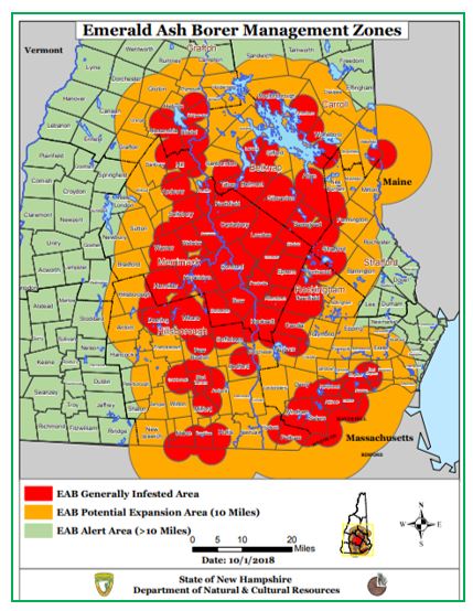
With more citizens visiting Livermore Falls, this means more eyes can be trained to look for invasive species that threaten the quality and future health of Livermore Falls State Forest and surrounding forests. .There are three species of highest concern, referred to as the big three, which threaten the forest health in NH- Emerald Ash Borer, Hemlock Woolly Adelgid, and Asian Long-Horned Beetle.
The Asian Long-Horned Beetle is the only species that has not yet been found in NH, as of October 2018,but there have been infestations as close as Worcester, Massachusetts. The other two species have both been creeping up from Southern New Hampshire and are starting to reach the lakes region and the foothills of the White Mountains. As depicted in Figure 1, the Emerald Ash Borer is of major concern in the southern part of the state and the Lakes Region; Livermore Falls is just to the north and west of this area.
Figure 1 shows the infestation of the Emerald Ash Borer as far north as the lakes region, just to the south and east of Livermore Falls.
Figure 2 shows the distribution of hemlock trees and the distribution of the Hemlock Woolly Adelgid infestation. This species is migrating north where the hemlock trees are more abundant. This is another major species of concern because it has already been identified in NH, and it looks like it is going to continue to spread.
Figure 2 The green is the distribution of the hemlock trees and the brown is the Hemlock Woolly Adelgid infestation.
The infestation of the three species can lead to decreases in quality of timber, tree populations and recreation. There will be a decline in recreation due to the decrease in tree quality and density of the forest. Activities such as birding, hiking, biking and cross-country skiing will be less desirable if there is damage to the forest. Less recreation and tourists negatively impacts the economy of New Hampshire.
Economic and Social Benefits of the State Forest at Livermore Falls
The forest is a crucial resource to the state of New Hampshire. It is a big part of our identity and is a place that can connect people to each other and to their environment. The forest also provides a massive source of revenue through timber sales and recreation. Figure 3 shows the forest-based economy plays a significant role in the overall economy of New Hampshire. It provides millions of dollars in revenue and creates thousands of jobs for residents. This is a quantifiable reason to reduce the spread of invasive species. Invasive species can spread through State Forests impacting the experience of visitors and the insects can spread to adjacent private, state, and federal forests. People should be aware of the benefits forests provide and understand why stewardship and sustainable management practices are so important.
Figure 3 Infestation of invasive insect species in the forest can impact the economic contribution of forest provisioning services.
Environmental Benefits of Livermore
In addition to social and economic benefits of forests, state forests provide an environmental benefit, particularly Livermore Falls state forest which make a great riparian buffer or stream buffer. This forested area, helps shade the river keeping the water cooler and with more oxygen. The forest provides a safe travel corridor for wildlife. Such buffers play a key role in maintaining water quality in adjacent rivers like the Pemi. The primary purpose of the buffer is to reduce the amount of sediment, chemicals and other pollutants entering the adjacent river Sediment and pollution being carried in the runoff is deposited in the buffer rather than in a stream. Figure 4 shows a basic model of a riparian buffer and the benefits that it provides. The future health of our forests and those forming buffers are at risk from the spread of invasive species such as the “big three”.
Figure 4 Benefits of healty stream buffers
What Can You Do?
If you have questions about invasive insects, call the UNH Cooperative Extension Forestry Information Center at:1-800-444-8978.
You can help protect New Hampshire's forests by:
Reporting suspect trees or insects.
Considering insecticide treatment of some trees.
Being aware of the risks of spreading.
Knowing and implementing best management practices to avoid transporting these pests.
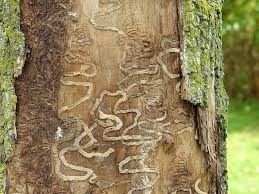
It takes years or decades for these pests to spread naturally, but humans can spread them in just hours or days. For that reason, the spread of invasive species is an essential issue to know about. Figure 5 shows quick references of different types of tree damage caused by each invasive species.
Figure 5 Emerald Ash Borer, Hemlock Woolly Adelgid, and Asian Long-horned Beetle
Conclusion:
There are countless benefits provided by state forests like at Livermore Falls in New Hampshire. Informational signage at Livermore Falls State Forest can help educate visitors about the importance of riparian forest buffers next to our rivers as well as the importance of detecting and controlling invasive species that can harm these very beneficial forests.
Resources:
Center, National Invasive Species Information. “State Resources - New Hampshire.” National Invasive Species Information Center, 8 Sept. 2018, www.invasivespeciesinfo.gov/unitedstates/nh.shtml.
Morin, Randall S.; Widmann, Richard H. 2016. Forests of New Hampshire, 2015. Resource Update FS-71. Newtown Square, PA: U.S. Department of Agriculture, Forest Service, Northern Research Station. 4 p.
My reflection on the beautiful geological features of Livermore Falls, NH.
By: Dillon Thompson edited by Dr. Mary Ann McGarry
The site is known for its beautiful rocky gorge that’s located right outside the White Mountain National Forest. This State Forest has diverse, unique archeology, ecology, hydrology, but stands out for its geological features. Many tourists and locals flock to this area to either take a quick dip into the Pemigewasset River or to admire the beautiful gorge and rock cliffs. I for one, have not and never will jump off the cliffs, or the one of a kind bridge that hangs over the gorge, but I have seen some daredevils jump.
The State Forest recently added a paved parking lot on the eastern Holderness side for up to 77 cars, along bathrooms, turning this place into a more welcoming family and tourist recreational area.
While a full-time environmental science and policy (ESP) major at Plymouth State University, during the summers of 2017 and ‘18 I served as manager of Livermore Falls State Forest learning more about the human and natural history of the place. I also had the opportunity to do research with a professor during the summer of 2018 which involved surveying the land. The goal was to determine how water flow patterns during flooding changed the shape of Livermore Falls State Forest below the falls on the eastern side. Underneath the forest’s green canopy, I examined soil deposits that show years of flooding history. Recently I’ve had the opportunity to articulate, write, and share about my knowledge as part of an outreach and communication project for an upper level ESP course. Class members teamed up to cover different aspects of Livermore Falls, the ecology, geology, fisheries, archeology, hydrology, and forestry. My partner and I researched the geological features including the rock type Camptonite composing the cross-cutting diabase dikes. The metamorphosed, now tilted sedimentary layers are prominent and the diabase dikes cut almost perpendicularly through the rock on the western side running from the sandy beach down to the narrow constricted passage through which the river flows.
How NH River Valleys Were Formed
The Pemigewasset River Valley bedrock is dominated by the metamorphic Littleton Schist. Thick glacially deposited sediments cover much of the area, except at Livermore Falls where metamorphic bedrock is exposed. Metamorphic rock forms from the transformation of pre-existing rock due to high heat and pressure. The once sedimentary rock, you can still distinguish the different colored layers of rock, were formed from deposits at the bottom of an ancient ocean roughly 450 million years ago, refer to Figure 1. Later, during the Devonian Period, about 420 million years ago, the compressed sediments which formed rock layers were uplifted, faulted, and tilted from plate tectonic forces.
Figure 1. Livermore Falls looking upstream. Notice the tilted, rock layers on the West side of the falls.
Weakly metamorphosed rock has been injected with magma (molten rock) of two different types. One was iron-magnesium rich which produced the Camptonite, and the other was silica rich which produced a type of rock known as “Aplite.” Both of these formed narrow, somewhat uniform tabular bodies of rock known as dikes that cut across the existing rocks . Since the dikes cut through the metamorphic rock, this means they are younger. (For example, if you’re going to cut a cake, the cake has to be there first). The dikes are not metamorphosed. About 2.5 million years in the past, during the Pleistocene Epoch, lobes of a continental glacier began, carving out the mountains and valleys of Northern New Hampshire. This erosional event happened after the bedrock formed and the dikes were injected. In one area at Livermore Falls, the Aplite dike cuts through the Camptonite dikes, indicating they are the youngest dikes and formation. There is a fault underneath the falls which caused the falls. The rock type is different on the two sides of the river. The river takes an abrupt turn at the fault. This causes the upper beach; the river encounters the beach, slowing down and dropping its sediment load before plunging down the falls.
As the glacier started to melt and recede approximately 13,000 to 8,000 years ago, the runoff made further geological modifications to the area. The large volume of meltwater eroded the bedrock, carrying sediments and depositing them along the river downstream. The last ice sheet that melted around 12,000 years ago erode and then deposited sand and gravel. The Livermore Falls steep gorge cascades down 12 feet.
The Discovery of Camptonite and Other Ancient Features
The main rare rock feature at the site is the outcrop of Camptonite. This rock type was first describe at Livermore Falls in 1879 by O.P Hubbard, and as is customary, the rock was named after the local town –Campton- where it was found. Camptonite, composed of an unusual chemical composition, is considered a Lamprophyre rock which is typically dark grey in color, and composed of mafic minerals such as amphibolite, augite, olivine, and biotite, Figure 2. The minerals that make up this type of rock are observed in a fine-grained to dense ground mass. Geologists claim the rock originates in the earth’s mantle with alkaline basalt rocks.
Figure 2 Camptonite.
The Livermore Falls area also consists of basalt and quartz veins as well as deposits of black mica. Glacially carved potholes can also be found in the bedrock ranging in size from 1 to 5 feet in diameter. These are the youngest geologic erosional features.
You want Geology Puns? Give me a Minute, I’ll Dig Some Up
After digging up all this information on the geology of Livermore Falls, it really opened up ideas for sharing this discovery with others. The goal is to develop a visual and engaging story about the formation of Livermore Falls that will educate the public and bring awareness on the uniqueness of the area. The intent is to have people who think they are coming just to swim and recreate at the beautiful spot, leave- thinking about the history of the site and intrigued by the type of rock that lies below them and how all these features forming the falls came to be.
Our Rocking Ideas
The idea is to display informational on both sides of the State Forest above and below the falls. An aerial image of Livermore Falls can have different symbols and colors representing different geological features, so people can know what they are looking at, and where to locate specific rock types.
Next to the map can be a description of each of the different rock types with a rock sample or picture for visitors to examine and match with descriptions provided, refer to Figure 3. After making a determination, participants could slide or lift up a flap, and underneath read more about the type of rock. A sign can provide an introductory description of how the area formed. On the bottom of the sign will be a scanner code for phones that will take people to an informational video that could include an interview and tour with a professional geologist.
Figure 3, aerial view of Livermore Falls showing the falls and bedrock at the top of the image.
The goal is for people to walk away with information they can share with friends and family to spread the word that Livermore Falls is full of beautiful and unique geologic and other natural features so the site can become a source of pride for surrounding communities. What we value and respect, we will help protect.
References:
Davis, Larry. “Field Trips Near and Far: Pemi's Nature Program.” Camp Pemigewassett, July 2014, camppemi.com/2014/08/12/nature-program-field-trips/.
FERC. “Livermore Falls Hydroelectric Project, Pemigewasset River Basin, Grafton County: Environmental Impact Statement by - Books on Google Play.” Google, Google, 1 Jan. 1990, play.google.com/store/books/details?id=_u00AQAAMAAJ&rdid=book-_u00AQAAMAAJ&rdot=1.
Goldthwait, J., Goldthwait, L., & Goldthwait, R. (1951). Geology of New Hampshire. Part 1 Surficial [PDF]. Concord: New Hampshire state planning and development commission.
Kemp, James Ferman. “A Handbook of Rocks for Use Without the Microscope.” Google Books, D. Van Nostand Company, 1918, books.google.com/books?id=EmBbAAAAcAAJ&pg=PA195&lpg=PA195&dq=Camptonite%2Brock%2Bdiscovered%2B1879&source=bl&ots=K-C3W72-mq&sig=mvmYEO0ukcKHcGnofL0KTd9iHCs&hl=en&sa=X&ved=2ahUKEwiYh6TJ343eAhUHZd8KHZGPDGoQ6AEwCXoECAQQAQ#v=onepage&q=Camptonite%20rock%20discovered%201879&f=false.
P. (1993, January 20). Pemigewasset Wild and Scenic River Study [PDF]. NH state parks service.
“The Geology of New Hampshire: A Report Comprising the Results of Explorations Ordered by the Legislature, Volume 3 by New Hampshire. Geological Survey, 1868-1878 - Books on Google Play.” Google, Google, 1 Jan. 1878, play.google.com/store/books/details?id=Mftub2vIgicC&rdid=book-Mftub2vIgicC&rdot=1
Livermore falls is a beautiful area located in Grafton County. There are two entrances to the site: one in Campton, one in Plymouth. The entrance in Campton was recently repaved and looks much more welcoming for visitors. Past the parking lot there is a beautiful ecosystem with quite a few different habitat types. A trail takes you through a mixed deciduous forest to a small beach along the Pemigewasset River. On the beach there are picnic tables and toilet facilities, and an air compressor to inflate tubes for those who want to float the down the river. Many different species inhabit the site. Birds persist throughout the area. In early morning you can hear their songs throughout the park. There are turtles on the beaches, and salamanders under logs and rocks. Everywhere you look, you’ll see evidence of life. The idea for this piece came from a class trip to the site. One of my professors saw an odd track in the sand, a long indention running between the footprints. We soon saw the creator of the tracks, a common snapping turtle- dragging its tail. I knew then that I wanted to write about animal species in the park.
On an early September morning I ventured back into the park to look for the perfect species to write about. I wanted to make sure every species I highlighted was physically there, and not just a species whose range overlaps with the Livermore Falls Park. A fellow birder friend joined me. We performed point counts, listening for all recognizable birds in the area. The bird point protocol consists of standing in a specific location and counting birds. One counts the number of individual birds (of each species) within a circle of a certain radius. In most cases, especially when gathering data to compare one point count to the next, radius size should be consistent as well as the length of time one counts, Figure 1.
Figure 1. A typical 20 m (m=meter) radius point count where one person counts all the birds seen or heard within a 10 minute period.
My friend works firsthand with salamanders and easily procured one from under some woody debris. Here is some information about the friends you’ll find living in Livermore Falls’ State Forest.
Early mornings, in the hemlock hardwood pine forests, you can hear a distinct song that descends in pitch, and resonates as if whirling around inside a metal pipe (Cornell). The owner of this lovely call is a veery (Passeriformes turdidae). They breed in dense, damp woodlands, often near rivers and streams, as one finds at Livermore Falls These beautiful birds forage mostly on the ground, so when you visit from spring to fall, make sure to look out for them!
A more colorful resident of the park is none other than the Northern parula (Passeriformes parulidae). These flashy blue and yellow warblers are closely associated with mosses or lichens that grow on the branches of canopy trees. Here, in the north they use beard moss, a type of lichen. These birds prefer Eastern hemlock, sugar and red maple, and birch trees. Their song is a rising buzzing trill that ends with a final sharp note (Cornell). These birds feed on spiders and insects and can be seen hopping from branch to branch.
Winter may drive away many migratory tropical birds, but no cold temperatures can stop New Hampshire’s smallest all season birds. This tiny, less than 5g bird, can survive temperatures as low as -40 C. The golden crowned kinglet (Passeriformes regulidae), a charismatic little light brown bird with a golden crown, survives the winter by feasting on snow fleas (Bull 1995)! Snow fleas are a small species of dark blue springtail that are often seen jumping around the surface of snow.
Look for the track of the common snapping turtle (Chelydra serpentine) as described above! It was a bit odd to observe a snapping turtle on the more northerly beach on the Plymouth side during the fall in the early afternoon on our class fieldtrip to the Livermore Falls site. Female snapping turtle typically lay eggs in early summer, but depending on when she mated, egg-laying may extend into autumn, as we observed. Turtles are much more comfortable in the water and come ashore to lay eggs. Snapping turtles can weigh up to 70 pounds. These creatures are just as fierce as they look, with a mouth that is beak like to tear and cut apart their prey. Their diet ranges from herbivorous matter, fish, reptiles, and birds (NHFG). If you happen to stumble upon one, avoid getting close: they are truly the grumpy old men of Livermore Falls.
The spotted salamander (Ambystoma maculatum) can also be found at the site, hiding under rocks, logs, boards and debris. They come out on warm spring nights to breed in pools where they produce almost 200 eggs per female, attaching those eggs to submerged vegetation (NHFG). Warm, rainy days and nights in spring and fall are the perfect time to search for migrating salamanders.
Going to Livermore Falls to search for its wonderful inhabitants is a pastime any person could get behind. There is so much to explore and learn, I would taking a walk through, and experience life’s wonders for yourself.
References
Cornell Lab of Ornitology. Retrieved 12-3-18; : http://www.birds.cornell.edu/Page.aspx?pid=1478
Miller, Lisa. The Mating Season and Reproduction of the Snapping Turtle: https://animals.mom.me/mating-season-reproduction-snapping-turtle-1721.html, accessed 12- 3-18.
Silverberg, J. (2012). Snapping Turtle. Wildlife Journal , 23-24.
Spotted Salamander. (2014, May). Retrieved from New Hampshire Fish and Game: https://wildlife.state.nh.us/wildlife/profiles/spotted-salamander.html
Gone from our waters, but not from our history: the salmon of the Merrimack River and its Pemigewasset headwaters
Ryan Heisler and edited by Mary Ann McGarry
Introducing Atlantic Salmon:
A Native Relationship
the confluence of the Pemigewasset, (affectionately referred to as the Pemi), and the Winnipesaukee River is where the beautiful waters of the Merrimack River begin. The Merrimack, meaning swift water place, and its headwaters- the Pemi River, was the lifeblood for Native American tribes that thrived off of the river’s many resources. One of the most important resources was the Atlantic salmon that migrated from the river’s mouth in northeastern Massachusetts past Livermore Falls north of Plymouth New Hampshire.
Together the spring rains and snowmelt were the key triggers signaling the King Salmon of the Atlantic that they needed to begin their massive migratory runs up the rivers. The indigenous tribes who feasted on the salmon, welcomed the return of the migratory fish up the rivers, after the long, cold New England winters. Not only did the fish have to get past the eager anglers, the fish had to navigate 14 waterfalls, including the one at Livermore Falls.
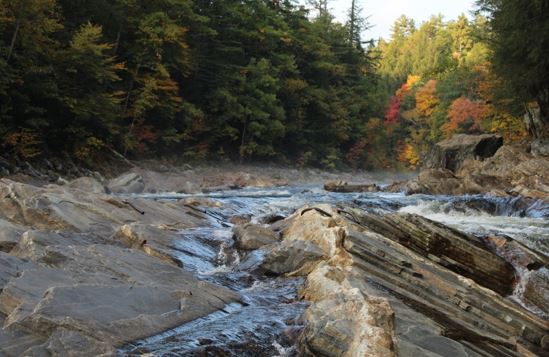
A Beautiful Autumn image of Livermore Falls looking up river
The Decline of Giants
Salmon are programmed to jump and so navigating up a waterfall wasn’t and isn’t an insurmountable obstacle. However, the industrial boom of the Europeans in the 1800’s proved to be the demise of the Atlantic salmon in New Hampshire. The river which served as the original highway of New England allowed goods to be sent back and forth between the rural towns and the growing city of Boston. To create better conditions for this developing transportation route, dams, canals, and locks were built. This new infrastructure complicated the path of migrating Atlantic salmon, and in some sections these structures completely cut off the fishes path. The Amoskeag Dam, just north of Manchester, New Hampshire, was the site of the first fishway designed to allow the salmon migration to continue. However, in 1847 when the 30-foot high, Essex dam, was constructed in Lawrence, Massachusetts; the passage of the fish further upstream was essentially blocked. The Essex dam was a closed door, one that all anadromous species knocked on, but none were able to pass through. This feature drove the Atlantic salmon of the Merrimack and its watershed to extinction.
The beginning of Restoration
Throughout the period of dam construction salmon hauls began to wane, taking an exceptional days catch from 100 fish down to a messily 10. This decline and the decimation of livelihoods that existed because of the fish sparked interest in restoration. Initial efforts started in New Hampshire, from a man by the name of Henry A. Bellows who is recognized as the man who secured the appointment of commissioners in 1864, who were tasked with investigating the decline of the migratory fish in both the Merrimack and Connecticut rivers. With the help of many professional naturalists, like Professor Louis Agassiz, Bellows presented his case to the Massachusetts legislature over a four day period. At the conclusion of this committee meeting, Bellows was rewarded with a joint agreement between Massachusetts and New Hampshire to tackle the restoration efforts as a united front.
Power was given to commissioners to demand dam facilities create fish passage and if no action was taken within a period of time deemed reasonable, the commissioners had the authority to collect revenue funds from the facilities from the state treasurer. These funds were then used to install fish passage devices. By 1868, fish-ways were installed far enough up the Merrimack that passage to the headwaters was possible, however it wasn’t clear if it was suitable passage.
The Origins of Stocking
Alongside the efforts to free the river flow to the Atlantic, repopulation efforts were put into place. A dentist by the name of Dr. William Fletcher of Concord was one of the first to begin an effort to restore young Atlantic salmon to the Merrimack River. He traveled to New Brunswick, Canada in the fall of 1866 and obtained fertilized Atlantic salmon eggs with the permission of the province. Collecting a total of 70,000 eggs, he was then faced with the difficult task of returning to the Merrimack with as many viable eggs as possible. His most successful method of transporting these eggs was to pack them inside of a Champagne basket packed with damp moss. The eggs traveled by ship and rail back to the headwaters of the Merrimack, where they were deposited into artificially prepared beds. It was recorded that nearly 90% of Dr. Fletcher’s eggs survived and hatched within the Pemi River, sparking more efforts to collect and relocate fertilized eggs from our northern neighbors.
It was the successful transplant of Dr. Fletcher’s egg that led to a need for a more local egg source. Maine became the source for eggs; the fish were manually spawned and the eggs were fertilized by hand. These large operations took the participation of every state involved and showed the determination of the region to restore the salmon populations. It wasn’t long before the state of New Hampshire began building its own hatch house, the very first of its kind in the state. It was decided in early 1874 that the best location would be along the Pemi River, below Livermore Falls.
The First State Hatch-House
Although the first state hatch house was to be on the Pemi, the project was to be funded by both New Hampshire and Massachusetts. The intent was to collect salmon that were returning to the river, hold them within a dammed up spring pond, and then milk the adults for their eggs and milt (fish sperm). Once harvested, the eggs would be fertilized in long troughs that were plumbed to another spring on site. The clean and cold spring water would provide the two things the eggs needed to remain healthy. After hatching, the fry were kept until they were of par size to assure a better survival rate in the wild.
The early efforts were not successful and to this day the Atlantic salmon fail to migrate up their once native waters. Many feel like modern efforts to reintroduce the salmon are a waste of funds, whiles others are still very committed to restoring once native populations. Now there are even more impacts and threats, including Increasing water temperatures, poor water quality, and invasive species. There are still large hurdles to overcome. The Atlantic salmon were the pride of many eastern rivers and even if they are gone from the Pemi, they can’t be written out of our history books and hopefully one day we’ll be able to celebrate their return.
Washed Away: Flooding at Livermore Falls, New Hampshire
Kat Crowley, edited by Mary Ann McGarry
Historic Flooding (Pre-2000)
To early settlers, Livermore Falls seemed an ideal place for a mill: rushing water constricted by the bedrock gorge and plenty of timber to build the powerhouse and dam. The first mill was constructed in 1773 and various mill operations ran until 1950. Unfortunately for the mill owners, natural disasters —floods and fires — occurred with astonishing frequency and forced mill owners to rebuild often. The worst flood, nicknamed the “Pemi Flood,” happened in June 1973, when Hurricane Agnes devastated the dam and powerhouse at Livermore Falls. Fortunately, mill operations had ceased decades prior.
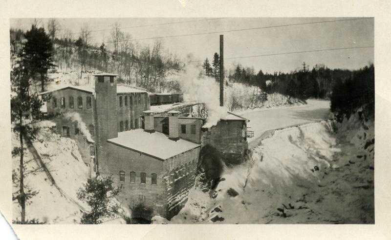
Livermore Falls Mill via Friends of the Pemi Livermore Falls Chapter Website
In 1988, an organization attempted to create a hydropower facility at Livermore Falls, but the Federal Regulatory Energy Commission denied the permit due to flooding concerns. A study showed that the hydropower facility could have caused flooding as far upstream as North Woodstock, about 15 miles away. Although dams can reduce flooding by storing floodwater and releasing it slowly, when the stored floodwater is not released quickly enough it causes further flooding upstream.
Any future opportunity to rebuild the dam was terminated in 1991 when the New Hampshire Legislature passed HB674. This bill designated the Pemigewasset River to the New Hampshire Rivers Management and Protection Program, preventing dams from being constructed on the Pemi. This decision protects the Pemi from future flow alterations and is beneficial for migratory fish species.
Current Flooding (Post-2000)
The sound of rushing water greets me as I arrive at Livermore Falls Beach. As I walk across the sand toward the Pemigewasset River, I think of how different this landscape looked a year ago at the height of the October 30th, 2017 flood. During that storm, the Pemi River rose from 2.5 feet to nearly 20 feet and flooded Holderness near the Plymouth State University Ice Arena and the Holderness I-93 exit. The Livermore Falls Beach was flooded and the falls were nearly unrecognizable, swollen and angry from the storm flow.
Although this storm was touted as a 100-year flood, it was really closer to a 10-year flood. People often have the misconception that a 100-year flood can only happen (or is only supposed to happen) once in a hundred years. In reality, this number refers to the probability of flooding each year. A two-year flood has a 50% probability of occurring every year, a 10-year flood has a 10% probability, a 100-year flood has a 1% probability, and so on.
You may protest: If a 100-year flood has a 1% probability each year, doesn’t that still mean that it only happens once every hundred years? Yes, in theory, a 100-year flood should happen once every hundred years on average. Flip a coin a few times. Does it land on heads every other time, perfectly? Probably not. But if you flipped it a hundred times, it should land on heads about 50% of the time.
Flipping Image via Shutterstock
These flood frequencies are based on historical data, and assume that storm frequency and intensity will remain constant. However, if larger storms continue to occur, the magnitude of these 10-year flood and 100-year flood events will increase: what was once a 100-year flood shifts toward a 10-year flood. Several other storm events of the magnitude of the October 2017 storm have impacted communities around the Pemi River in recent memory. In late August 2011, rain fell at the rate of 1-1.5”/hour for several hours during Hurricane Irene and the Pemi River rose 20 feet. The February 2017 ice jam flood submerged the Plymouth State University commuter lot and destroyed dozens of cars. The July 2017 flood destroyed sections of Route 25A, a well-traveled road.
Why are these floods becoming more common? As development creeps into the floodplain of the Pemi River, the land loses its capacity to absorb all the rainwater and the river has to carry the large storm flows. Increased impervious surface cover, such as parking lots and buildings, prevent water from soaking into the ground. Instead, the water travels into the river as stormwater runoff. This creates more frequent and intense flood events and downstream communities suffer.
Future Flooding
As I gaze out at the Pemigewasset River from Livermore Falls Beach on this crisp fall morning, with the sound of the falls in the background, I wonder how high the water will reach during the next significant flood. As the impacts of climate change become increasingly evident, floods like the one in August 2011, October 2017 and June 1973 will likely become more commonplace. Climate change can mean more intense weather events. How will Livermore Falls and the surrounding areas change from these flood events? What precious artifacts from this rich archeological site will be washed away? How can we adapt?
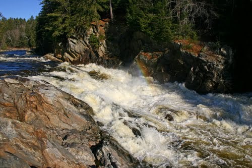
Livermore Falls at low flow, September 2018
Livermore Falls at high flow (date unknown) via Friends of the Pemi Livermore Falls Website
Fortunately, awareness and willingness to act is growing among communities near Livermore Falls. The Lakes Region Planning Commission surveyed people living along the Pemigewasset River corridor in 2010 and many respondents expressed concern about climate change. This issue hadn’t previously been addressed in Pemi River corridor management plans. Due to community interest, the 2013 update of the Pemi River corridor plan included five recommendations addressing increased flood risk from climate change.
These recommendations include:
educating communities on the hazards of building in the floodplain
encouraging towns to incorporate low impact development practices in local regulations
encouraging communities to consider the impacts of more frequent storm events
encouraging towns to adopt stormwater management ordinances
mapping areas susceptible to severe erosion using fluvial erosion hazard mapping.
If towns adopt these recommendations, our problems won’t disappear. We’ve altered the landscape in the Pemigewasset River corridor so significantly it will be hard to turn back, and so we will continue to see impacts from these changes for generations. However, these recommendations could mitigate the worst of the flooding and potentially prevent loss of property and, more importantly, loss of life. Our best hope moving forward is to maintain at least and ideally restore the river’s access to its floodplains as much as possible to better adapt to more intense storms and larger magnitude flood events.
Cultural Landscape Report and Environmental Assessment
Washed Away: Flooding at Livermore Falls, New Hampshire
Kat Crowley, edited by Mary Ann McGarry
Historic Flooding (Pre-2000)
To early settlers, Livermore Falls seemed an ideal place for a mill: rushing water constricted by the bedrock gorge and plenty of timber to build the powerhouse and dam. The first mill was constructed in 1773 and various mill operations ran until 1950. Unfortunately for the mill owners, natural disasters —floods and fires — occurred with astonishing frequency and forced mill owners to rebuild often. The worst flood, nicknamed the “Pemi Flood,” happened in June 1973, when Hurricane Agnes devastated the dam and powerhouse at Livermore Falls. Fortunately, mill operations had ceased decades prior.
In 1988, an organization attempted to create a hydropower facility at Livermore Falls, but the Federal Regulatory Energy Commission denied the permit due to flooding concerns. A study showed that the hydropower facility could have caused flooding as far upstream as North Woodstock, about 15 miles away. Although dams can reduce flooding by storing floodwater and releasing it slowly, when the stored floodwater is not released quickly enough it causes further flooding upstream.
Any future opportunity to rebuild the dam was terminated in 1991 when the New Hampshire Legislature passed HB674. This bill designated the Pemigewasset River to the New Hampshire Rivers Management and Protection Program, preventing dams from being constructed on the Pemi. This decision protects the Pemi from future flow alterations and prevents additional barriers that would impede migratory fish species’ passage.
Current Flooding (Post-2000)
The sound of rushing water greets me as I arrive at Livermore Falls Beach. As I walk across the sand toward the Pemigewasset River, I think of how different this landscape looked a year ago at the height of the October 30th, 2017 flood. During that storm, the Pemi River rose from 2.5 feet to nearly 20 feet and flooded Holderness near the Plymouth State University Ice Arena and the Holderness I-93 exit. The Livermore Falls Beach was flooded and the falls were nearly unrecognizable, swollen and angry from the storm flow.
Although this storm was touted as a 100-year flood, it was really closer to a 10-year flood. People often have the misconception that a 100-year flood can only happen (or is only supposed to happen) once in a hundred years. In reality, this number refers to the probability of flooding each year. A two-year flood has a 50% probability of occurring every year, a 10-year flood has a 10% probability, a 100-year flood has a 1% probability, and so on.
You may protest: If a 100-year flood has a 1% probability each year, doesn’t that still mean that it only happens once every hundred years? Yes, in theory, a 100-year flood should happen once every hundred years on average. Flip a coin a few times. Does it land on heads every other time, perfectly? Probably not. But if you flipped it a hundred times, it should land on heads about 50% of the time.
Flipping Image via Shutterstock
These flood frequencies are based on historical data, and assume that storm frequency and intensity will remain constant. However, if larger storms continue to occur, the magnitude of these 10-year flood and 100-year flood events will increase: what was once a 100-year flood shifts toward a 10-year flood. Several other storm events of the magnitude of the October 2017 storm have impacted communities around the Pemi River in recent memory. In late August 2011, rain fell at the rate of 1-1.5”/hour for several hours during Hurricane Irene and the Pemi River rose 20 feet. The February 2017 ice jam flood submerged the Plymouth State University commuter lot and destroyed dozens of cars. The July 2017 flood destroyed sections of Route 25A, a well-traveled road.
Why are these floods becoming more common? As development creeps into the floodplain of the Pemi River, the land loses its capacity to absorb all the rainwater and the river has to carry the large storm flows. Increased impervious surface cover, such as parking lots and buildings, prevent water from soaking into the ground. Instead, the water travels into the river as stormwater runoff. This creates more frequent and intense flood events and downstream communities suffer.
Future Flooding
As I gaze out at the Pemigewasset River from Livermore Falls Beach on this crisp fall morning, with the sound of the falls in the background, I wonder how high the water will reach during the next significant flood. Climate change is already causing more intense storm events. As the impacts of climate change become increasingly evident, floods like the one in August 2011, October 2017 and June 1973 will likely become more commonplace. How will Livermore Falls and the surrounding areas change from these flood events? What precious artifacts from this rich archeological site will be washed away? How can we adapt?
Fortunately, awareness and willingness to act is growing among communities near Livermore Falls. The Lakes Region Planning Commission surveyed people living along the Pemigewasset River corridor in 2010 and many respondents expressed concern about climate change. This issue hadn’t previously been addressed in Pemi River corridor management plans. Due to community interest, the 2013 update of the Pemi River corridor plan included five recommendations addressing increased flood risk from climate change.
These recommendations include:
educating communities on the hazards of building in the floodplain
encouraging towns to incorporate low impact development practices in local regulations
encouraging communities to consider the impacts of more frequent storm events
encouraging towns to adopt stormwater management ordinances
mapping areas susceptible to severe erosion using fluvial erosion hazard mapping.
If towns adopt these recommendations, our problems won’t disappear. We’ve altered the landscape in the Pemigewasset River corridor so significantly it will be hard to turn back, and so we will continue to see impacts from these changes for generations. However, these recommendations could mitigate the worst of the flooding and potentially prevent loss of property and, more importantly, loss of life. Our best hope moving forward is to maintain at least and ideally restore the river’s access to its floodplains as much as possible to better adapt to more intense storms and larger magnitude flood events.
Resources:
“Historical Gallery.” Friends of the Pemi Livermore Falls Chapter, livermorefalls.org/historic-photos/.
“Environmental Gallery.” Friends of the Pemi Livermore Falls Chapter, http://livermorefalls.org/environmental-gallery/
“Livermore Falls Gorge: A Timeline.” Friends of the Pemi Livermore Falls Chapter, http://livermorefalls.org/wp-content/uploads/Historic-Timeline-.pd
WMUR-TV. “Raw Video: Pemigewasset River Rages after October Storm.” YouTube, 30 Oct. 2017, www.youtube.com/watch?v=7lgPPckGZGA.
Pemigewasset River Local Advisory Committee. “Pemigewasset River Corridor Plan.” Department of Environmental Services, 2013, https://www.des.nh.gov/organization/divisions/water/wmb/rivers/documents/pemi-plan.pdf
Gray & Pape, Inc. "Cultural Landscape Report and Environmental Assessment: Livermore Falls, Grafton County, New Hampshire." 22 Dec. 2015.