The Rocking Geology of Livermore Falls
My reflection on the beautiful geological features of Livermore Falls, NH.
By: Dillon Thompson edited by Dr. Mary Ann McGarry
The site is known for its beautiful rocky gorge that’s located right outside the White Mountain National Forest. This State Forest has diverse, unique archeology, ecology, hydrology, but stands out for its geological features. Many tourists and locals flock to this area to either take a quick dip into the Pemigewasset River or to admire the beautiful gorge and rock cliffs. I for one, have not and never will jump off the cliffs, or the one of a kind bridge that hangs over the gorge, but I have seen some daredevils jump.
The State Forest recently added a paved parking lot on the eastern Holderness side for up to 77 cars, along bathrooms, turning this place into a more welcoming family and tourist recreational area.
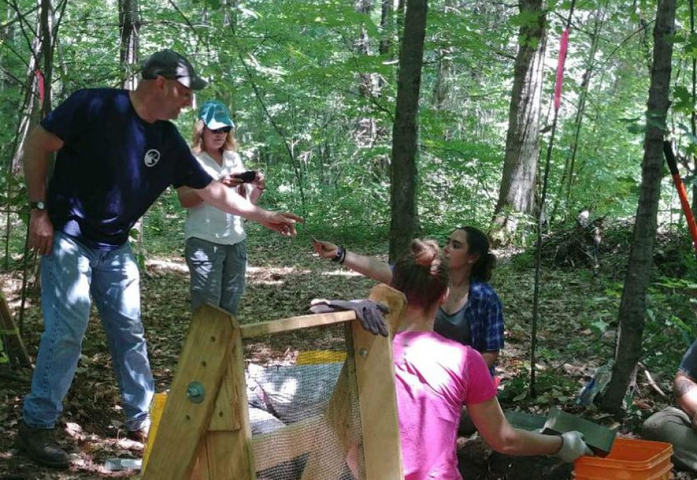
While a full-time environmental science and policy (ESP) major at Plymouth State University, during the summers of 2017 and ‘18 I served as manager of Livermore Falls State Forest learning more about the human and natural history of the place. I also had the opportunity to do research with a professor during the summer of 2018 which involved surveying the land. The goal was to determine how water flow patterns during flooding changed the shape of Livermore Falls State Forest below the falls on the eastern side. Underneath the forest’s green canopy, I examined soil deposits that show years of flooding history. Recently I’ve had the opportunity to articulate, write, and share about my knowledge as part of an outreach and communication project for an upper level ESP course. Class members teamed up to cover different aspects of Livermore Falls, the ecology, geology, fisheries, archeology, hydrology, and forestry. My partner and I researched the geological features including the rock type Camptonite composing the cross-cutting diabase dikes. The metamorphosed, now tilted sedimentary layers are prominent and the diabase dikes cut almost perpendicularly through the rock on the western side running from the sandy beach down to the narrow constricted passage through which the river flows.
How NH River Valleys Were Formed
The Pemigewasset River Valley bedrock is dominated by the metamorphic Littleton Schist. Thick glacially deposited sediments cover much of the area, except at Livermore Falls where metamorphic bedrock is exposed. Metamorphic rock forms from the transformation of pre-existing rock due to high heat and pressure. The once sedimentary rock, you can still distinguish the different colored layers of rock, were formed from deposits at the bottom of an ancient ocean roughly 450 million years ago, refer to Figure 1. Later, during the Devonian Period, about 420 million years ago, the compressed sediments which formed rock layers were uplifted, faulted, and tilted from plate tectonic forces.

Figure 1. Livermore Falls looking upstream. Notice the tilted, rock layers on the West side of the falls.
Weakly metamorphosed rock has been injected with magma (molten rock) of two different types. One was iron-magnesium rich which produced the Camptonite, and the other was silica rich which produced a type of rock known as “Aplite.” Both of these formed narrow, somewhat uniform tabular bodies of rock known as dikes that cut across the existing rocks . Since the dikes cut through the metamorphic rock, this means they are younger. (For example, if you’re going to cut a cake, the cake has to be there first). The dikes are not metamorphosed. About 2.5 million years in the past, during the Pleistocene Epoch, lobes of a continental glacier began, carving out the mountains and valleys of Northern New Hampshire. This erosional event happened after the bedrock formed and the dikes were injected. In one area at Livermore Falls, the Aplite dike cuts through the Camptonite dikes, indicating they are the youngest dikes and formation. There is a fault underneath the falls which caused the falls. The rock type is different on the two sides of the river. The river takes an abrupt turn at the fault. This causes the upper beach; the river encounters the beach, slowing down and dropping its sediment load before plunging down the falls.
As the glacier started to melt and recede approximately 13,000 to 8,000 years ago, the runoff made further geological modifications to the area. The large volume of meltwater eroded the bedrock, carrying sediments and depositing them along the river downstream. The last ice sheet that melted around 12,000 years ago erode and then deposited sand and gravel. The Livermore Falls steep gorge cascades down 12 feet.
The Discovery of Camptonite and Other Ancient Features
The main rare rock feature at the site is the outcrop of Camptonite. This rock type was first describe at Livermore Falls in 1879 by O.P Hubbard, and as is customary, the rock was named after the local town –Campton- where it was found. Camptonite, composed of an unusual chemical composition, is considered a Lamprophyre rock which is typically dark grey in color, and composed of mafic minerals such as amphibolite, augite, olivine, and biotite, Figure 2. The minerals that make up this type of rock are observed in a fine-grained to dense ground mass. Geologists claim the rock originates in the earth’s mantle with alkaline basalt rocks.

Figure 2 Camptonite.
The Livermore Falls area also consists of basalt and quartz veins as well as deposits of black mica. Glacially carved potholes can also be found in the bedrock ranging in size from 1 to 5 feet in diameter. These are the youngest geologic erosional features.
You want Geology Puns? Give me a Minute, I’ll Dig Some Up
After digging up all this information on the geology of Livermore Falls, it really opened up ideas for sharing this discovery with others. The goal is to develop a visual and engaging story about the formation of Livermore Falls that will educate the public and bring awareness on the uniqueness of the area. The intent is to have people who think they are coming just to swim and recreate at the beautiful spot, leave- thinking about the history of the site and intrigued by the type of rock that lies below them and how all these features forming the falls came to be.
Our Rocking Ideas
The idea is to display informational on both sides of the State Forest above and below the falls. An aerial image of Livermore Falls can have different symbols and colors representing different geological features, so people can know what they are looking at, and where to locate specific rock types.
Next to the map can be a description of each of the different rock types with a rock sample or picture for visitors to examine and match with descriptions provided, refer to Figure 3. After making a determination, participants could slide or lift up a flap, and underneath read more about the type of rock. A sign can provide an introductory description of how the area formed. On the bottom of the sign will be a scanner code for phones that will take people to an informational video that could include an interview and tour with a professional geologist.
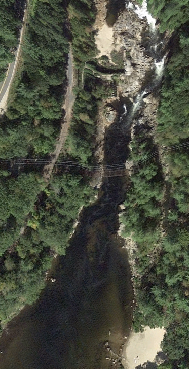
Figure 3, aerial view of Livermore Falls showing the falls and bedrock at the top of the image.
The goal is for people to walk away with information they can share with friends and family to spread the word that Livermore Falls is full of beautiful and unique geologic and other natural features so the site can become a source of pride for surrounding communities. What we value and respect, we will help protect.
References:
Davis, Larry. “Field Trips Near and Far: Pemi's Nature Program.” Camp Pemigewassett, July 2014, camppemi.com/2014/08/12/nature-program-field-trips/.
Davidson, Michael W. “Camptonite.” Molecular Expressions Microscopy Primer: Specialized Microscopy Techniques - Polarized Light Microscopy Gallery - Camptonite, 20 Nov. 2003, micro.magnet.fsu.edu/primer/techniques/polarized/gallery/pages/camptonitesmall.html.
“Environmental Fact Sheet: The Pemigewasset River.” Environmental Fact Sheet, NHDES, 2017, Davidson, Michael W. “Camptonite.” Molecular Expressions Microscopy Primer: Specialized Microscopy Techniques - Polarized Light Microscopy Gallery - Camptonite, 20 Nov. 2003, micro.magnet.fsu.edu/primer/techniques/polarized/gallery/pages/camptonitesmall.html.
FERC. “Livermore Falls Hydroelectric Project, Pemigewasset River Basin, Grafton County: Environmental Impact Statement by - Books on Google Play.” Google, Google, 1 Jan. 1990, play.google.com/store/books/details?id=_u00AQAAMAAJ&rdid=book-_u00AQAAMAAJ&rdot=1.
Goldthwait, J., Goldthwait, L., & Goldthwait, R. (1951). Geology of New Hampshire. Part 1 Surficial [PDF]. Concord: New Hampshire state planning and development commission.
Kemp, James Ferman. “A Handbook of Rocks for Use Without the Microscope.” Google Books, D. Van Nostand Company, 1918, books.google.com/books?id=EmBbAAAAcAAJ&pg=PA195&lpg=PA195&dq=Camptonite%2Brock%2Bdiscovered%2B1879&source=bl&ots=K-C3W72-mq&sig=mvmYEO0ukcKHcGnofL0KTd9iHCs&hl=en&sa=X&ved=2ahUKEwiYh6TJ343eAhUHZd8KHZGPDGoQ6AEwCXoECAQQAQ#v=onepage&q=Camptonite%20rock%20discovered%201879&f=false.
- P. (1993, January 20). Pemigewasset Wild and Scenic River Study [PDF]. NH state parks service.
Parsons, Greg. “Livermore Falls - New Hampshire.” New England Waterfalls, www.newenglandwaterfalls.com/nh-livermorefalls.html.
Pemi. River Advisory Committee. “The Pemigewasset River Corridor Management Plan.” Pemigewasset River Corridor Plan, NHDES, 2013, https://www.lakesrpc.org/PRLAC/files/PemiCorrMgmentPlan2013.final.pdf.
“Pemigewasset Wild and Scenic River Assessment.” Rivers, Town of Plymouth, 1 Jan. 1993, www.rivers.gov/documents/studies/pemigewasset-draft-study-appendices.pdf.
Vernon, Jim. “LIVERMORE FALLS GORGE; A General History with Background on the Pemigewasset River in Grafton County, New Hampshire.” Geology of the Lakes Region, 2005, http://livermorefalls.org/wp-content/uploads/Livermore-Falls-general-facts-about.pdf.
“The Geology of New Hampshire: A Report Comprising the Results of Explorations Ordered by the Legislature, Volume 3 by New Hampshire. Geological Survey, 1868-1878 - Books on Google Play.” Google, Google, 1 Jan. 1878, play.google.com/store/books/details?id=Mftub2vIgicC&rdid=book-Mftub2vIgicC&rdot=1